
By Alexis Jackson, Howard T. Odum Center for Wetlands, UF

What are wetlands?

A wetland is a transitional area between upland and aquatic ecosystems. All wetlands have the three following characteristics:
1. Vegetation that is adapted to grow in wet conditions (hydrophytes)
2. Unique soil that develops in anaerobic conditions (hydric soil)
3. Seasonal or periodical inundation or saturation
Wetlands are critically important ecosystems both for the services they provide to humans and for their role in the broader environment. Wetlands have the capacity to remove pollutants, hold and release water during periods of flood and drought, and store large amounts of carbon — helping to mitigate anthropogenic climate change. Wetlands also provide a unique habitat for many species of fish, birds, amphibians, plants, and insects.
What is the EPA NWCA?
The Environmental Protection Agency’s National Wetland Condition Assessment is a survey aiming to quantify the condition of our nation’s wetlands.
The first survey was conducted in 2011, and the assessment is repeated every five years. Data from 1234 wetlands surveyed in 2011 and 2855 wetlands surveyed in 2016 are available on the EPA’s website. The Howard T. Odum Center for Wetlands has performed field research and analysis for Florida for each iteration of the NWCA.

To assess the ecological condition of each wetland, vegetation, soil, and water chemistry samples and hydrology, weather, buffer, and general field observations are collected. These factors are evaluated to reflect key stress indicators and ecological health for each region within the USA.
The number of wetlands surveyed in each state is related to the state’s total wetland area. In Florida, which has the largest wetland area of any state other than Alaska, 50 wetlands were surveyed in the summer of 2021. Selected Florida wetlands spanned the state from Tate’s Hell Swamp in the Florida panhandle to Sugarloaf Key in the Florida Keys!
What does a typical field day look like?
The FL NWCA crew includes a crew leader (Alexis Jackson), a lead botanist (Tony Davanzo, also known as “barefoot Tony”), and a rotating cast of incredible field crew members, listed below. Getting the crew to the target wetland safely is the most important goal — and can be incredibly tricky. The lead botanist and I use the aerial maps, agency contacts, and a Global Positioning System (GPS) to navigate to the coordinates, which can sometimes require distant hikes, canoes, air boats, and other machinery that aides in traveling through challenging wetlands.

Once at the wetland, the total area we directly observe is a 40-m radius circular plot called the Assessment Area (AA). The AA becomes our home for several hours while we work to collect all required data. Outside of the AA we set up “buffer plots”, which are four 140-m transect lines originating from the center of the AA. We walk these 140 m transect and document any physical, chemical, and biological alternations we observe, such as vegetation removal, ditching and non-native plants.
Within the AA, we collect three major types of data: soil, water, and vegetation.
Soil

Hydric soils are probably the most important but misunderstood characteristics of wetlands. Hydric soils aid in water storage and nutrient cycling and serve as a habitat for microbes, insects, and animals. By mapping wetland soil characteristics across the entire country, scientists can better understand how soil structure and function reflect wetland ecological condition.
To collect soil samples, we dig a 125-cm-deep soil pit. This can be difficult depending on water level, vegetation, and soil texture. Once the soil pit is dug, we identify the soil horizons (layers) and for each horizon note the soil texture, smell, and color. We then collect four different soil samples: soil chemistry, bulk density cores, standard depth core, and soil isotopes. These are used to analyze soil particle size, total carbon, nitrogen, sulfur, pH, calcium carbonate, electrical conductivity, and other variables.
Water

The properties of water in wetlands can directly reflect their productivity, indicator stressors, and environmental influences. To understand wetland water quality, we take three water samples:
Microcystin is one group of natural toxins that occurs when an excessive amount of various cyanobacteria (blue-green algae) blooms. These toxins are found in lakes, oceans, and rivers that are connected to wetlands and therefore can cause unfavorable changes in plant growth, illness, and even death to aquatic animals.
Chlorophyll-a is the primary pigment of photosynthesis that absorbs light. High biomass of algae (indicated by high chlorophyll-a) can cause a decrease in dissolved oxygen levels when algae degrade and can also release toxins that are harmful to humans and aquatic wildlife.
Water chemistry: these samples include standard measures of chlorophyll-a, conductivity, ammonia, nitrate, total nitrogen, phosphorus, and pH.
Vegetation

Wetland plants are specially adapted to their environment and are relatively easy to identify, making them an effective indicator of wetland status. Understanding plant species composition and abundance provides insight into human disturbance, species interactions, and global climate change.
There are 5 vegetation plots that our Lead botanist and a lucky helper observe. Within these plots, every plant is identified and given a height class and percent cover. Then five species of plants are randomly selected and sampled to assure that the botanist is accurately naming the plants. We call these “Quality Assurance” plants or “QA Plants.”
50 wetlands later and the Florida Crew has completed the survey for the third time!

Specials thanks to the Florida Fish and Wildlife Conservation Commission, Dr. David Kaplan, Dr. Kelly Reiss, Dr. Johanna Freeman, and all the amazing people we have met while conducting this survey. We couldn’t have done this without the support and determination of every one of you!
University of Florida
Alexis “AJ” Jackson – Crew Leader
Anthony “Tony” Davanzo – Lead Botanist
Florida Fish and Wildlife Conservation Commission
Bailey Piper
Evan Robins
Alyssa Ward
Scott Gilb
Shawn Clemons
Elizabeth White
More fantastic photos in the 2021 NWCA fieldwork gallery
About the author, Alexis Jackson:
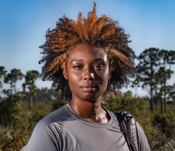
My name is Alexis Jackson or AJ, and I received my bachelor’s degree in biological sciences from Virginia Polytechnic Institute and State University (Virginia Tech). While at Virginia Tech, I did many undergraduate research projects in wetlands and found myself thoroughly enjoying the ecosystem. Mainly because of its many functions and benefits to our planet and their diversity in shape, size, vegetation, and wildlife. While in my first year in graduate school, I have had the privilege of being the Florida crew leader for the 2021 Environmental Protection Agency’s national wetland condition assessment.